Features
LastLift has a whole host of features to help your ski trips run smoothly.
With an intuitive interface, LastLift is easy to use, meaning there’s no delays in getting on the slopes.
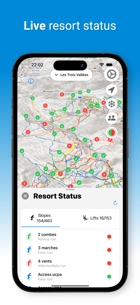
Live resort status
With lifts and slopes opening and closing in response to snow and weather conditions and daylight, it can be difficult to plan a suitable route. LastLift will shows you the current status of lifts and slopes to help you make informed decisions.
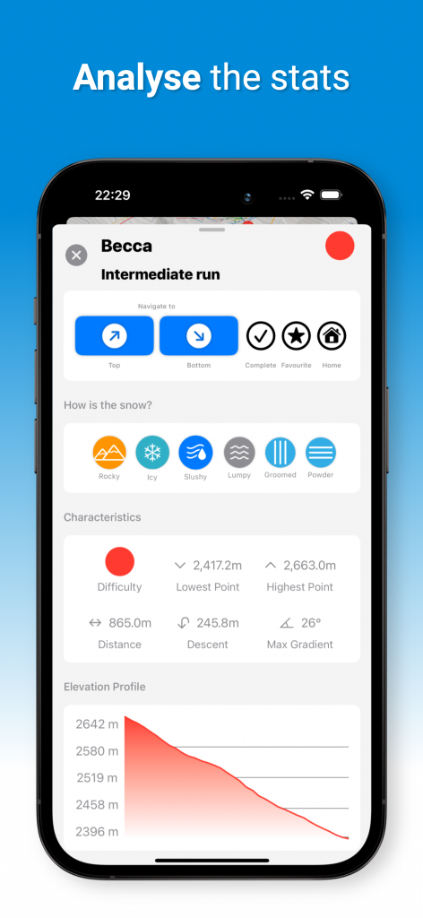
Lift and slope info
For every slope you can see the altitude, gradient, and distance and you can toggle slope difficulty on and off in settings if you don’t fancy the black runs, or the greens aren’t challenging for you. You can also see the features of each lift: the type of lift, the maximum occupancy, the duration, start and end altitude, and even whether or not it’s heated.
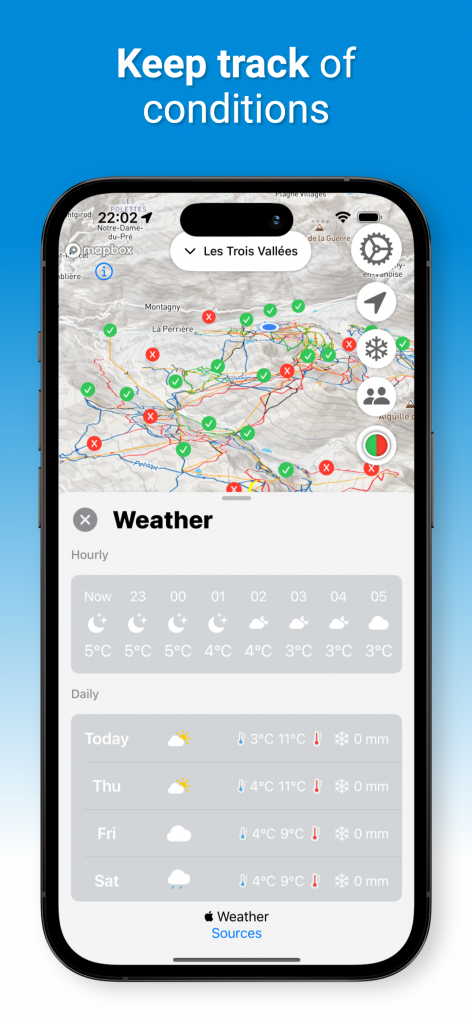
Live weather forecast
Weather in the mountains can be volatile, so check out the weather conditions before you set out for the day, and keep up to date with an hourly forecast for the next 24 hours, as well as a view of the next 3 days.
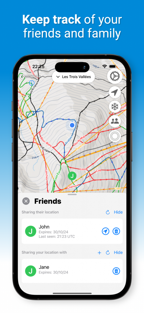
Location Sharing
The conditions on the slopes are so changeable, depending on footfall and the weather conditions. You often don’t know until you’re at the top, with only one way down! We’ll soon be able to let you know the condition of the pistes, based on near real-time user feedback so you can plan accordingly.
Thousands of resorts
With maps for 3,000 resorts across the world, you only need 1 app for all of your ski trips. Just activate the resort map you would like the first time you use the app, and then switch easily using the selector available in the menu.
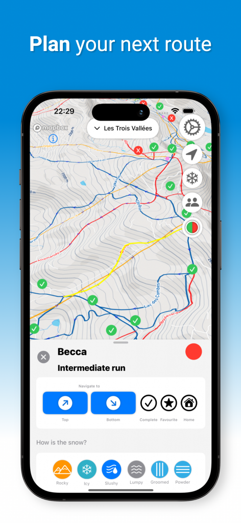
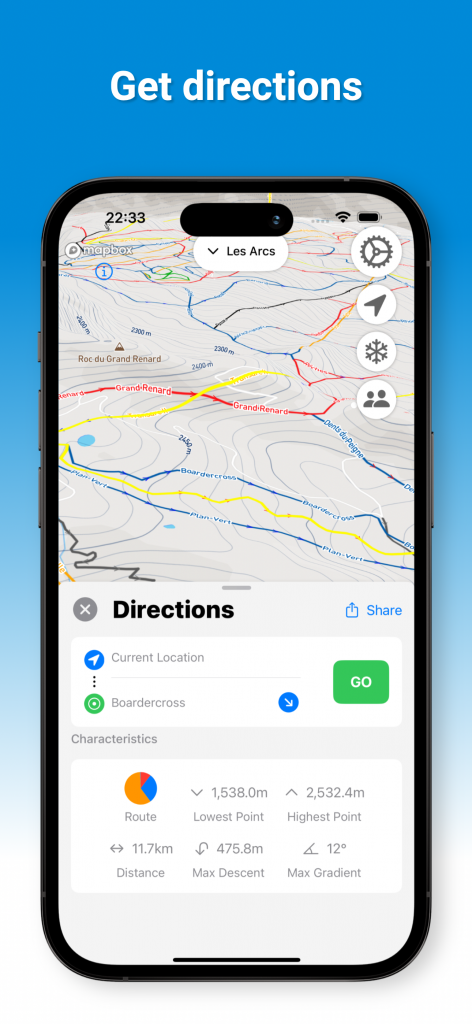
Point to point navigation
Know where you’re trying to get to, but not sure how to get there? Using your live location LastLift will show you the best route to your desired destination, whether it be a slope, lift, bar or restaurant. With flyover views to help you visualise the route, a route summary and clear step-by-step instructions, it couldn’t be easier to get to where you want to be.
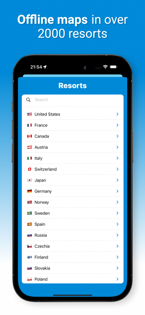
Offline maps
Don’t want to use your data, or struggle with signal on the slopes? Every resort is downloadable to your phone, taking only a couple of seconds to download. The map files are small (<1MB), so don’t take up loads of valuable photo space.
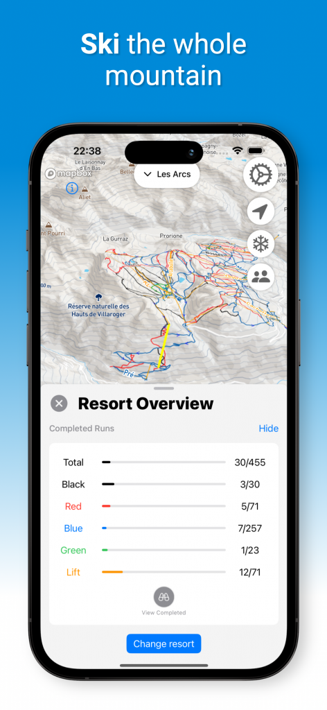
Piste completion
You can tick off every piste you complete, and see how much of the resort you’ve covered. Then when you navigate via a new route, you can see if you’ve completed any of it before, or if its totally new. Race to get to 100% anyone?